Who among us has not despaired when trying to read and understand the ICAO chart? Especially with complex airspace structures, such as those found around airports, it can be very nerve-wracking trying to read and understand the ICAO chart. Ultimately, it’s also a question of safety; it can happen very quickly that you overlook an airspace. Furthermore, it is not always easy to visualise the airspaces in three-dimensional space.
But it’s no use: if you want to carry out a thorough briefing for your flight plan, you need to familiarise yourself with the airspace on the planned route. Austro Control offers help, at least on Austrian territory, in the form of an interactive online map.
Getting started
After logging in to the Austro Control home briefing page at www.homebriefing.com and clicking on Online Map VFR Austria, you will be taken to the Spatial Data Infrastructure page. The disclaimer must be observed; it states, for example, that the online map alone may not be used for the briefing. I will explain in detail below why it still makes sense to use it.
A compact online help (MapStore Quick Guide) and further information can be accessed from this page.
Click on Continue to the application and Online Chart VFR Austria to access the actual interactive online chart VFR Austria.
From the following section onwards, only the most important functions that are organised around the map are explained. I have not mentioned the functions that are self-explanatory or, in my opinion, less important.
Background cards
The following background cards can be selected at the bottom left:
Basemaps are the so-called administrative base maps of Austria. The representation is in grey with contour lines; this is of course advantageous for creating a flight plan and getting an impression of the topology of the planned route. The map and all other maps, with the exception of OpenStreetMap, are limited to Austria only.
OpenStreetMap is the well-known map service. The heights of the mountains and their names are displayed here. As the map also extends beyond the borders of Austria, it is useful for planning cross-border flights. However, the airspaces are only displayed within the borders of Austria.
There are other maps available, but they are less interesting for us paraglider pilots.
Toolbars
On the right-hand side there is a toolbar with a white and blue background.
Creation of a PDF of the desired map section including legend. This function could be helpful if you want to have a map section available offline.
Info about this content
Here once again the explicit note that the chart may not be used for operational use. I interpret this as an indication that specific flight planning may still only be carried out with the official ICAO chart with legal certainty.
Measure distance, area and bearing
Distances and directions can be measured by setting points on the map or entering coordinates (units of measurement can be selected) and displayed in a table. Setting the waypoints is completed by double-clicking.
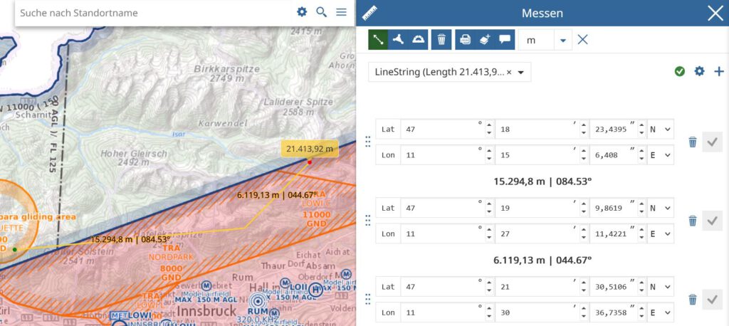
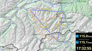
I will continue to measure distances with ThermiXC, as the other functions of ThermiXC are also perfectly tailored to us paragliders.
Share
The URL and the QR code as well as the social media Facebook, X (formerly Twitter) and LinkedIn are available for sharing the set marker. For IT experts, the embedded code and the API can be copied.
My position
Locate your own position. If you are sitting at your PC, the position is determined via the IP address of your Internet connection.
Query object on the map
Probably the most powerful tool that the interactive online map has to offer and therefore deserves its name. To find out details about the airspace structure for a specific point on the map, click on any point on the map after selecting the flag symbol. A dialogue with detailed information on the airspace structure opens on the right-hand side. Please note: The desired airspaces (see layer below) must be visible for them to be displayed in the dialogue.
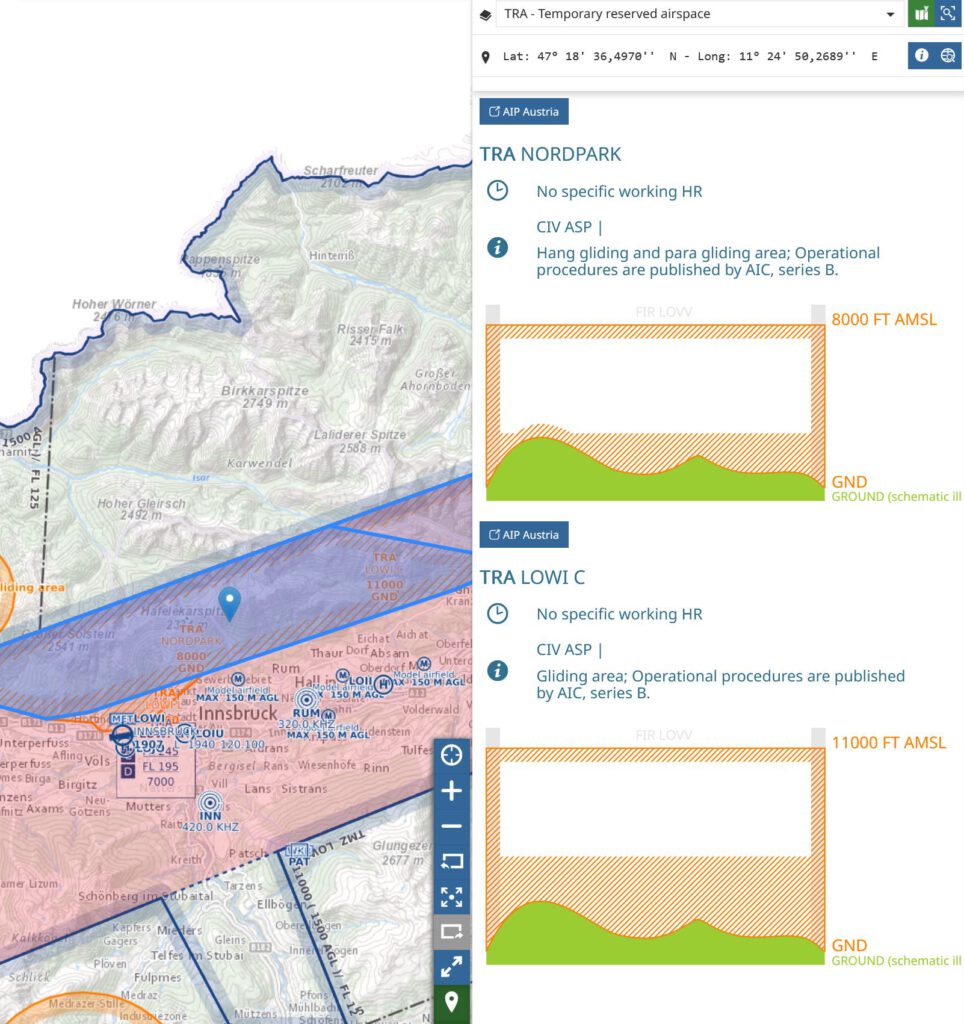
At the top of the drop-down list, you can select different areas of airspace that are available for the selected point. In this case north of Innsbruck Airport, these are: CTR – Control Zone, TMA – Terminal Control Area, TRA – Temporary Reserved Airspace and FIR – Flight Information Region. Below this, the coordinates of the selected point are displayed and a link to the AIP Austria is provided.
This is followed by detailed information and a graphical representation of the airspace area selected above. Anyone who is unsure about reading the ICAO chart will find help here. But I also believe that pilots who use the ICAO chart will find it easier to use this visualisation, as it is easy to overlook something, especially in a complicated airspace structure. It is helpful to activate the Highlight object on map icon (icon at the top right of the dialogue) so that the areas selected in the drop-down list are highlighted on the map at the same time. Among other things, the airspace identifier, operating hours, description of the airspaces and the upper and lower limits of the respective airspaces are displayed graphically.
Layer
In this menu, layers can be visualised and groups can be deleted and created.
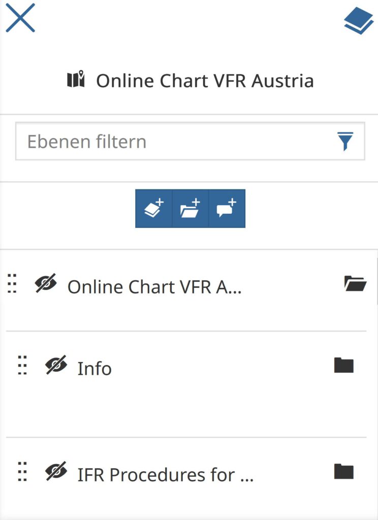
Switch group visibility
By clicking on the eye symbol, all layers that are subordinate to the group can be shown or hidden on the map. Please note that if the subordinate layer is switched on or off individually, this will not be displayed in the superordinate group or you will only see that certain layers are switched on or off when the group is open.
By selecting Online Chart VFR Austria on entry, a preselection of layers has already been made. However, I think it makes sense to switch on all airspaces in the Airspaces group. In order to have a comparison with the ICAO chart, it may be useful to temporarily switch on the Aeronautical Chart group. Depending on your flight plans and interests, it is also advisable to take a look at the other levels. For example, it may make sense to switch on the VFR approach procedures for uncontrolled aerodromes. This is important insofar as increased aerodrome traffic is to be expected and these areas should therefore be avoided as far as possible.
Conclusion
With this online map, Austro Control offers us a comprehensive and powerful tool with many possibilities. I will therefore certainly use the online chart more often, especially as the ICAO chart is really difficult to read with a complicated airspace structure. You can also use the chart to learn how to read the ICAO chart by comparing the online chart with the ICAO chart. One exercise could be to first try to understand the airspace structure of the ICAO chart and then cross-check the result with the online chart. This is a benefit for other countries that do not provide an online map.