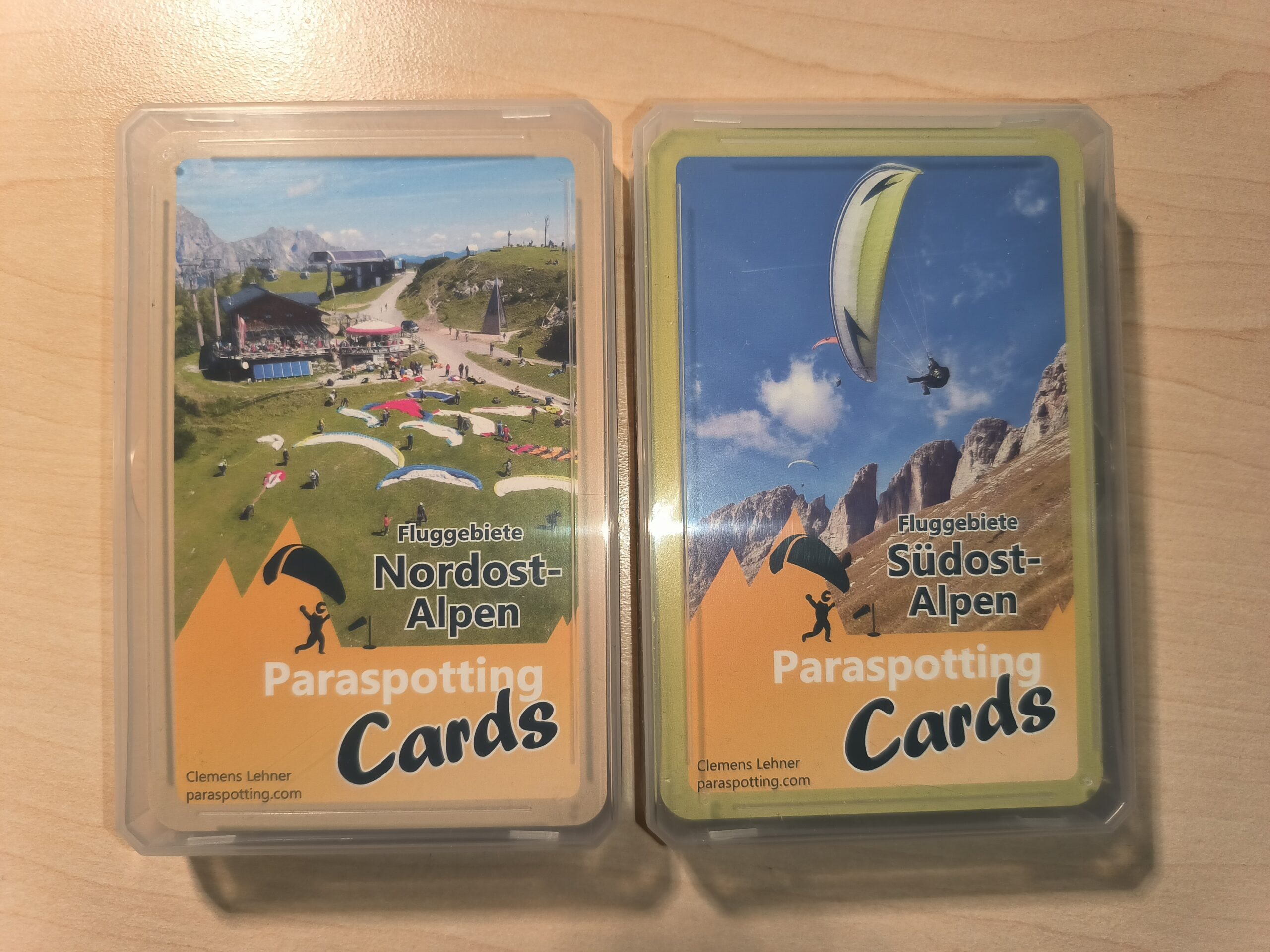
We’ve all been there: you want to go on a flying holiday on your own and are faced with the problem of finding information about the flying area of your choice. Nowadays there are many sources on the Internet, but you have to search for them laboriously. Wouldn’t it make sense to be able to fall back on a single source? Clemens Lehner offers such a source in playing card format.
Clemens kindly provided me with two sets of paraspotting cards for the flying areas in the south-east and north-east Alps free of charge.
Flight area information
The map sets are divided into 32 flying areas each in the Southeast and Northeast Alps regions. The maps in playing card format themselves provide very concise information about the respective flying area. The symbols on the maps of the flying areas are explained on the third map of the map set. The explanations of the symbols on the maps are written in German and English, but the flight area information (text and video) itself is only available in German.
Most of the flying areas are familiar to me, such as Brauneck or Buchenberg, but the set also includes flying areas that are unknown to me, such as Scuol or Schnifis.
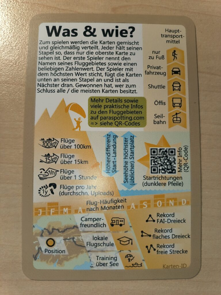
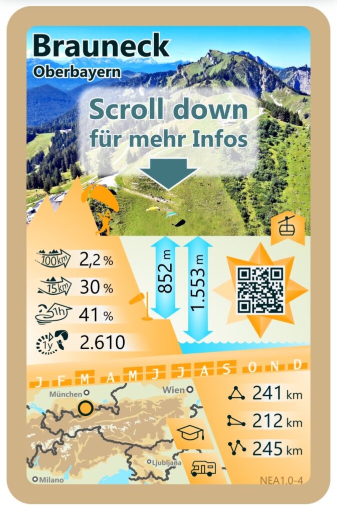
The following symbols are shown on the maps: Percentage for flights over 15 and 100 km, flights over 1 hour and flights per year (average uploads), altitude difference take-off – landing, sea level highest (usual) take-off site, main means of transport (only on foot, private vehicle, shuttle, public transport and cable car), frequency of flights by month, the position of the flying area on a map, whether a campsite and local flying school are available and whether training over sea is possible.
Of particular interest to cross-country pilots is information on the respectiveFAI triangle, flat triangle and free flight records. The information provides an initial overview of the cross-country potential of the flying area.
Further information on the flying areas can be obtained by scanning the QR code printed on the maps with your smartphone. This will take you to the paraspotting.com website, where the map is graphically displayed again.
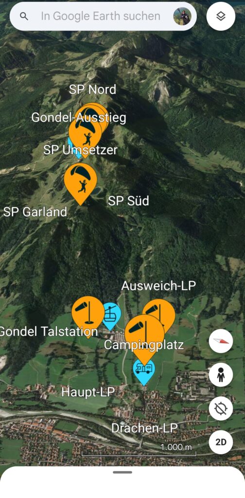
This is followed by a 3D view of all take-off and landing sites in the flight area. Clicking on the 3D view button takes you to the Google Earth app. The 3D view in the app provides a very good overview, which is very helpful if you have not been to the flying area before. Clicking on the flags does not provide any further information.
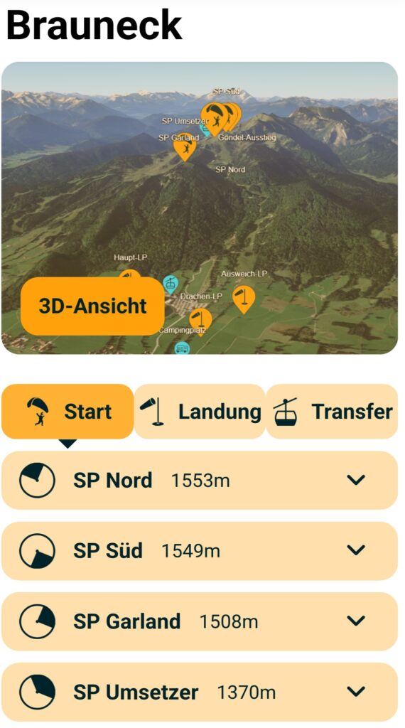
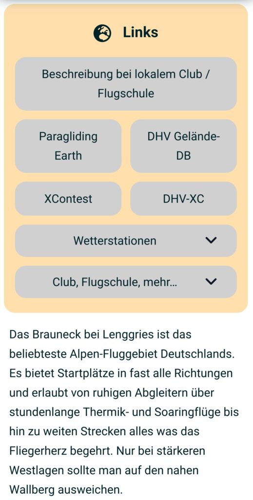
If available, a short presentation of the respective take-off and landing sites as a YouTupe video and or a more or less detailed explanation as text. Unfortunately, as is usual on modern websites today, you have to click on the headline to open each piece of information. Although the concept offers a quick overview, the disadvantage is that you have to open the detailed information first. Click on Location to display the location of the take-off or landing site in your own sat nav app.
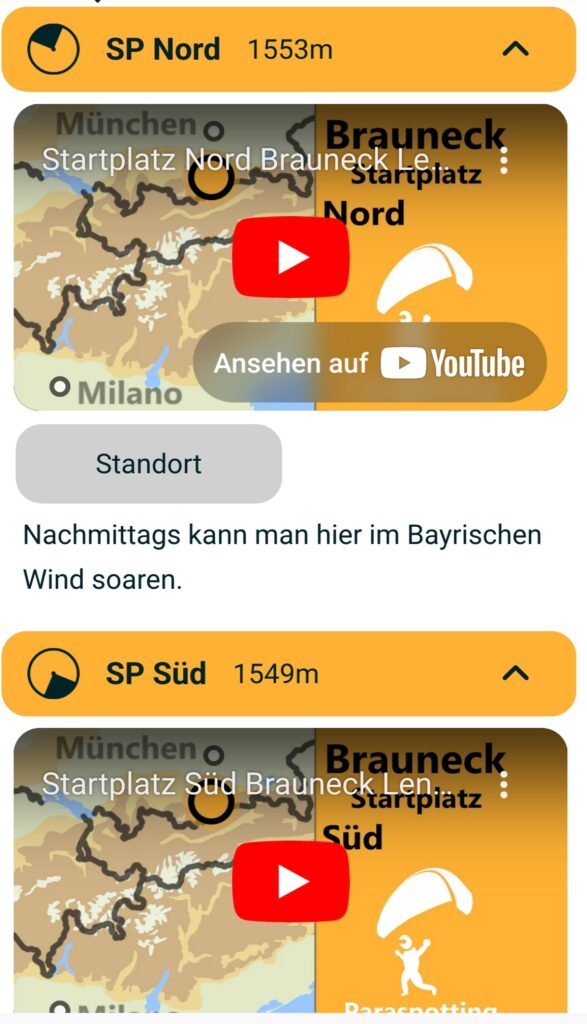
This is followed by links to other websites, such as the description at the local club or flying school, to Paragliding Earth with a further description of the flying area, to the DHV Gelände-DB (database), to XContest, to flights that have been uploaded to the DHV-XC, to various weather stations (in the Brauneck example these are Holfuy and the Bavarian Avalanche Warning Service) and further links to the local clubs, flying schools, mountain railways and campsites.
Finally, Clemens asks for comments if any errors are found or questions remain unanswered.
Card game
Clemens suggests a card game, suitable e.g. for days when you can’t fly or for cosy get-togethers in the evening. As card games are not my thing, I didn’t test the card game. Its instructions in the original text: To play, shuffle the cards and deal them out evenly. Everyone holds their pile so that only the top card is visible. The first player announces the name of their flying area and a numerical value of their choice. The player with the highest value takes the trick, adds the cards to the bottom of their pile and is next in line. The winner is the player who has all/most cards at the end.
Conclusion
I have checked all links in the Brauneck and Bassano flight areas. In the Brauneck description, the XContest link did not work. Furthermore, a Holfuy weather station, which is probably currently under repair, is not accessible. Clemens has insider tips for the Bassano flying area. The XContest link did not work here either, possibly the directory structure on the XContest server has been changed.
What I liked was the amount of information in a concentrated form, as well as the many links to further information. If you are visiting a flying area for the first time or perhaps don’t yet know all the launch sites in a flying area, the Paraspotting Cards are a very good source of information.
What I liked less or where there is at least potential for improvement:
- A date of the last update of the flight area information would be helpful to assess how up-to-date the information is
- Which flight database and which time period was used to determine the flights over 15, 100 km, 1 hour and flights per year? I assume the DHV-XC database
- What do flight frequency figures by month refer to? What is the significance of a fully or only half-filled column?
- There is no overview of which cards belong to which card set. If the card sets are ever mixed up, you have a problem assigning them correctly again. Sorting would also be possible using the card shown, but I still think an overview would be useful
- Some of the flight area information could be more detailed
- I think it makes sense to have the flight area information in English, as there are now English-speaking pilots in Central Europe. The map with explanations of the symbols is also in English, perhaps something is being planned there
Some of the criticisms mentioned can be easily resolved, making it a worthwhile purchase, especially for beginners who do not want to join a guided tour but want to explore new flying areas on their own. But even experienced pilots will certainly find one or two new features. Due to the information on the respective card, the target group of the Paraspotting Cards is very broad: beginners, local mountain pilots, cross-country pilots, acro pilots and hike and flyers will all find relevant information here.
You can certainly get almost all the information for free from the Internet, but whether it’s worth the money is ultimately up to you to decide. A single map set is available for €25, both together for €40. If you opt for both sets of maps, that’s 65 cents per flying area. These can be ordered on the Paraspotting Cards homepage.

Pingback: Review & outlook November 2025 - Ad Nubes | Paragliding Blog