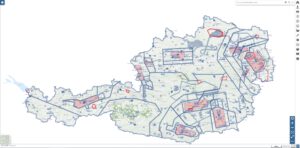
The interactive online map VFR Austria

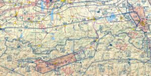
Who among us has not despaired when trying to read and understand the ICAO chart? Especially with complex airspace structures, such as those found around airports, it can be very nerve-wracking trying to read and understand the ICAO chart. Ultimately, it's also a question of safety; it can happen very quickly that you overlook an airspace. Furthermore, it is not always easy to visualise the airspaces in three-dimensional space.

Continue ReadingThe interactive online map VFR Austria

Four ways to retrieve NOTAMs

Every pilot who wants to take part in air traffic is obliged to call up the current NOTAMs as part of their personal briefing before the flight. Paragliders tend to neglect this, but of course this obligation also applies to us, at least if you want to go on a flight. But what options are there for retrieving NOTAMs and what do you need to bear in mind? What are the advantages and disadvantages of these methods?

Continue ReadingFour ways to retrieve NOTAMs

The Aeronautical Information Publication – An evaluation for paragliders

The Aeronautical Information Publication (AIP) is actually an important source of information for those who want to participate safely in air traffic. However, I can't remember it ever being discussed in the theory lessons for a paragliding license. It is worth taking a look at the AIP, as I have explained in the following article.

Continue ReadingThe Aeronautical Information Publication – An evaluation for paragliders

The airspaces in Bassano del Grappa and the surrounding area

Bassano is well known among paragliders, but what is less well known is what the airspace structure around Bassano looks like. Up to now I have hardly paid any attention to the airspace structure, but have flown as close to the slope as possible and not too far into the flat. However, I would like to change this and take a closer look at the airspace structure.

Continue ReadingThe airspaces in Bassano del Grappa and the surrounding area