Marcel Dürr had already proven in 2017 that the so-called Lenggries Glacier Triangle is doable with a sport class glider. But is the route also manageable with the standard class as an FAI triangle?
Pilot & Co-Author: Ralf Eichelsdörfer
Photos: Dmitry Balabanov & Philipp Reiser
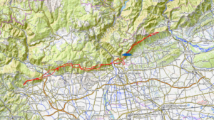
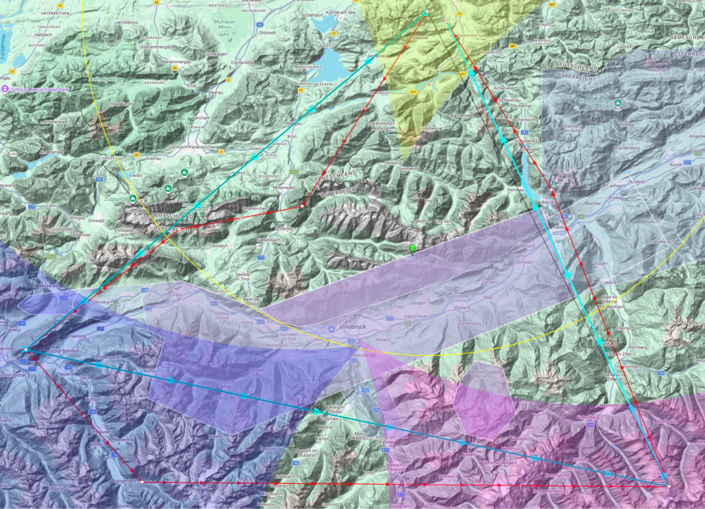
Marcel Dürr and Markus Kunz launched the Lenggries Glacier Triangle in the mid-2010s. At that time, it was still difficult to close the triangle, but the flight is now flown several times a year with a sport class glider. In order to fly a larger FAI triangle at that time without having to fly around the Innsbruck TMA, the northern turning point had to be set in the flatlands somewhere north of Bad Tölz. Flying completely around the Innsbruck TMA had not yet been attempted.
The TMA Innsbruck
The TMA (Terminal Manoeuvring Area), which surrounds the Innsbruck CTR (control zone), stretches from Tschirgant in the west to Zillertal in the east and thus forms a wall. However, the TMA can be flown under on the sides as it is staggered in height. The TMA LOWI 2 in the west with a lower limit of 9000 feet (approx. 2700 metres) is usually used to fly south. At the eastern end is TMA LOWI 4 at 8500 feet (approx. 2600 metres), which must be flown under if you want to reach Lake Achensee.
The route
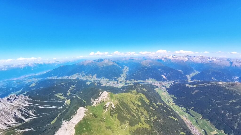
The start is from Brauneck, one of the best-known mountains for paragliders south of Munich. In order to fulfil the FAI regulations, one possible variant is to place the south-western turning point on the Tschirgant mountain east of Imst and the south-eastern turning point as far south as possible in the Zillertal valley on the border with Italy. The big challenge is to position the turning points in such a way that the last leg can be closed as far as possible towards Lenggries. The flights usually end in Zillertal or Inntal, as the TMA Innsbruck means you can only cross Inntal to the north at low altitude and the thermals are weak later in the evening. So far, only the high-flyers have managed the jump over the Achensee.
Preparation – relaxed, but not naive
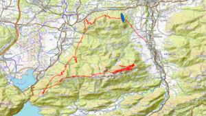
Sometimes it’s the days when you don’t plan everything down to the last detail that end up being memorable. 22 June 2025 was such a day. The second longest day of the year, high base, light winds, no overdevelopment – the full Alpine XC buffet. And my first serious attempt to fly the Lenggries glacier triangle – with a B glider.
There was no classic flight planning with many turning points. The route was familiar, the triangle had been flown many times before and the key points were prominent. The airspaces were clear, but I hadn’t saved any waypoints in the vario. I knew that I would be flying high on the day – so the airspace limits at the top were the challenge!
As always, a wide range of weather checks: DHV Wetter, Soaringmeteo, Meteo Parapente and Austro Control’s text weather. No subscriptions, no specialised knowledge, but a good gut feeling. Forecast: low wind, high base, no working day and no stress. Exactly what you want for a project like this.
Equipment? The Ikuma 3 P paraglider from Niviuk, the GTO light harness from Woody Valley and the Vario XC Tracer Mini II. It was to be the ninth flight with this glider. No Grödel, no crampons, no glacier emergency kit, but plenty of mountaineering experience. Looking back, this was absolutely sufficient, even if a landing in the high alpine area would have been necessary.
At the start – Brauneck, 9:30 am
We went up to Brauneck early with a few other pilots. The launch site was already very busy. The usual suspects with their high-flyers were of course the first to leave. I quickly got ready, switched on XC-Track and activated the live tracking of the preceding pilots – visual waypoints in real time, so to speak.
At this time of day, you start at the south launch site and everything feels good. That quiet, inner feeling: today is the day. The weather conditions corresponded to the forecasts and were almost ideal, a light, thermally supported southerly wind for the perfect start.
The flight – step by step into confidence
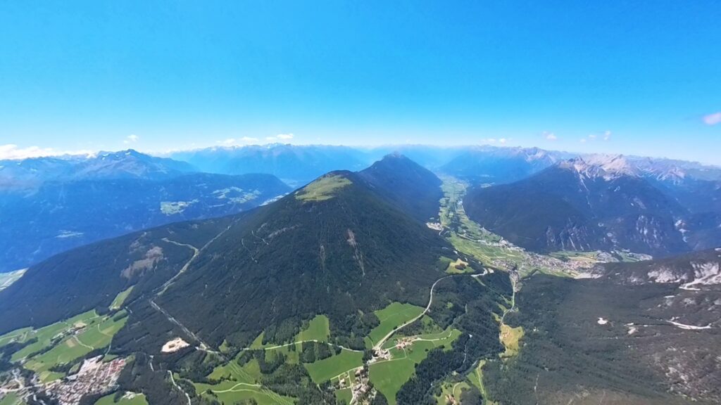
As usual, I made the first ascent over the ridge of the Brauneck, around ten minutes, then at around 2000 metres towards the Benediktenwand. From the Latschenkopf, I went directly over the Jachenau to the Staffel, following the motto: The day will be a long one, don’t mess around. Many people get some extra altitude on the Benediktenwand beforehand – my routine told me that the diversions wasn’t necessary today. And it worked out.
Arrived at the first waypoint Staffel at 1620 metres, clean thermals, up to 2100, on to Brünsteck. To the south-east of the Brünsteck there was good climbing again, so the second ridge was no problem. I also had no problems finding thermals on the mountain range leading to the Soiernspitze – just a good day. Even on average days, the probability of sinking is rather low here.
At the Soiernspitze, I cracked the 3000 metre mark for the first time. From here on, it was just great. Blue skies, little wind, long gliding sections – one of those days you’ve been looking forward to for so long. Before the traverse to the Arnspitzgruppe via the Isar, I gained a lot of altitude on the southern Karwendelspitze. With the reserve I was able to fly directly to the Arnspitze – no safety zigzag, but a direct line.
The thermals were a little rough, probably due to the northerly wind from the Isar valley, but they were easy to centre. From here onwards, the Karwendel pilots took off towards the Inn valley.
Decisions that work
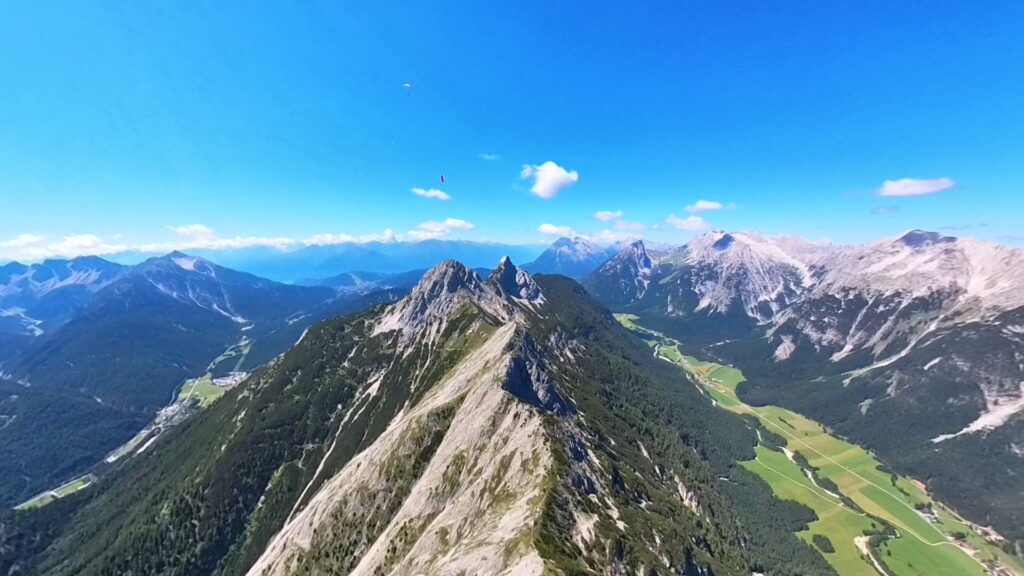
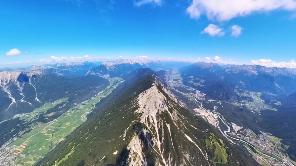
At the Gehrenspitze, the classic question arose: directly to the Hohe Munde or the faster, riskier route via the Predigtstein to the Niedere Munde? At just under 3100 metres, I opted for the latter. Across the Gaistal valley to the Mieminger Kette, through the gap of the Niedere Munde with safe altitude into the Inn valley, everything went surprisingly smoothly. From here on, the flight was new territory for me.
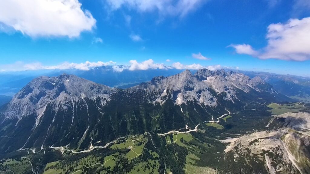
Then, along the Mieminger Kette, I was greeted by thermals that were almost too good. At the Griesspitze I was suddenly at 3150 metres and had to be careful: The nearby TMA Innsbruck sets a lower limit of 9000 feet (about 2740 metres).
The Simmering, the mountain after the valley crossing from the Mieminger Kette, is at 2096 metres, so the working height is 650 metres. That may sound like a lot, but it’s not when you consider that you have to keep a safe distance from the airspace and only descend during the long valley crossing. The valley crossing to Simmering is therefore more mentally challenging than it looks on paper. Take-off at 2700 metres, arrival at 2200 metres – with a constant view of the XC track and the airspace. The high performers have a clear advantage here due to their better glide angle!
The Tschirgant? Contrary to its reputation, it was surprisingly tame on this day. And the south-western turning point had been reached, even pushed out another 2.5 kilometres. The FAI triangle was alive. To enlarge the triangle further, you can move the turning point up to the Venet and beyond. But not my first time…
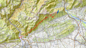
Ötztal, glacier world and long lines
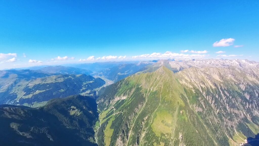
From the Tschirgant we continued into the Ötztal – also a longer crossing.
Towards the Neue Bielefelder Hütte it became rough and thermally tough, so keep flying into the valley, something will come up at some point. Once that was done, it was like running on rails on the east side of the valley. A classic race track. Turning was hardly necessary – and also not advisable because of the proximity to flight level 125, which is around 3800 metres, if you ignore the fact that the flight levels rise upwards in high-pressure areas, as was the case on this day. I still wanted to keep a safe distance, so I went straight ahead at full throttle.
At Längenfeld, you then turn east into the glacier world. A striking landmark is the Aqua Dome thermal spa and sauna world, which is not easy to spot from above at almost 3800 metres. I first flew southwards by mistake. Based on the (XC) track of a pilot flying ahead, I realised that I had to fly east. So I was one insight richer, at approx. 3300 metres above the valley floor, the huge Aqua Dome can also be overlooked. But in the Ötztal it was wearing everywhere – no matter.
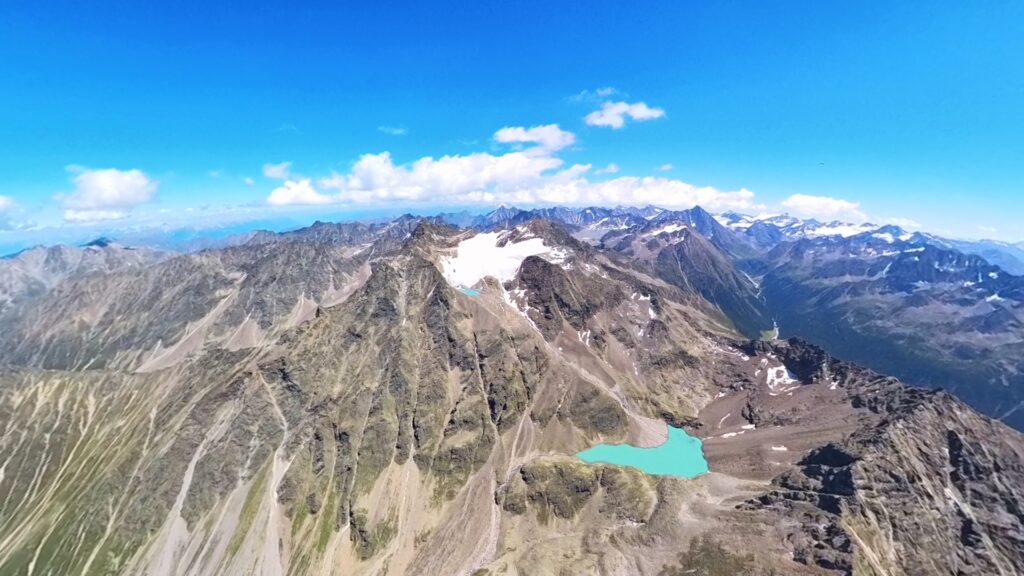
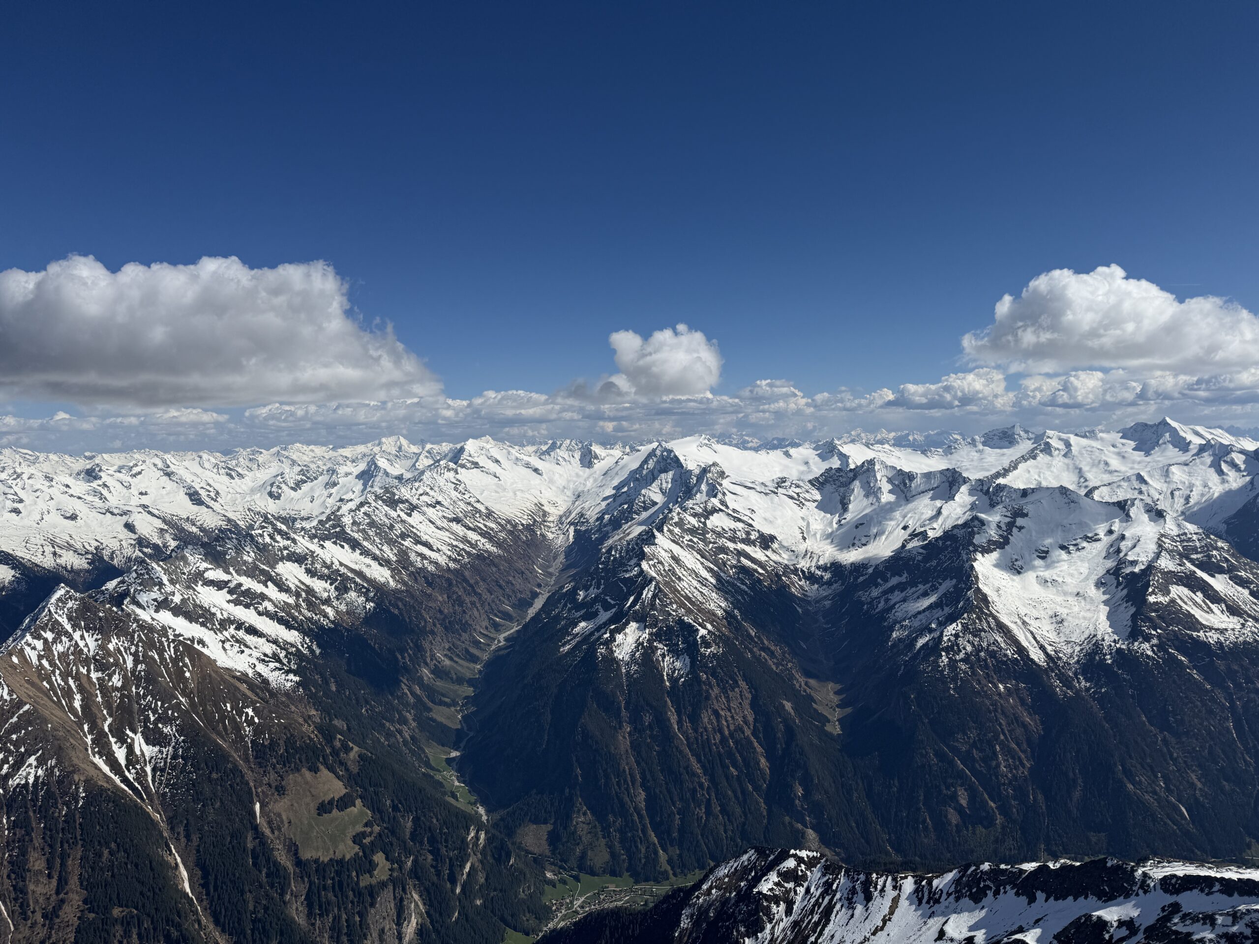
Towards the east, the landscape became steadily more rugged and desolate – I could easily maintain my altitude, but the valley floor came ever closer. Then the glaciers appeared, which were (now) smaller than expected. There were plenty of landing options, but you know that an outlanding here means a long walk back to civilisation.
As the high flyers had made their first turn further east, I was now close to them again, well-known sports friends from Lenggries and the Bodenlosen area. Same line, same thermals, same flow. The crossing into the Stubai Valley was almost a straight flight. In terms of time, everything was sewn to the edge – you couldn’t afford to crank much at this time of day. Up to this point I could always fly above grade. I was familiar with the Stubai Valley from the Fun Cup, so I was back on familiar terrain.
Brenner – the key point
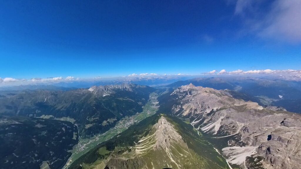
Before the Brenner Pass, I turned up to 3700 metres. Then came one of the longest gliding sections of the task: 13 kilometres. Due to the noticeable northerly wind that greeted me there, I had to keep a good head start, so that the previously gained altitude was quickly lost. On the east side of the Brenner, I arrived below the ridge for the first time, at around 2300 metres. I was able to warm up a bit down here and search the surrounding green hills for lift. But here, too, the aim was to fly as far into the valley as possible to avoid the north wind. The thermals became noticeably stronger, although not as strong as at midday.
Above the village of Navis, I was again at just under 3800 metres, again quite close to flight level 125, from where I could already see Hintertux in the Zillertal valley, so civilisation was once again within reach. Caution was still required at the flight restriction area (LO D 21 and LO R 7), which I flew around to the south.
Then a 15-kilometre glide to the Ahornspitze on the Hoher Riffler. I spared myself the trouble of turning up at Tristner, as other pilots were cranking at Ahornspitze and the sun was shining perfectly on the mountain. As expected, I arrived at the Ahornspitze below zero, but was able to turn up again to 3600 metres in the gentle evening thermals – it’s always nice when plans work out.
Right at the top
When I entered the Grossglockner airspace, there was suddenly air upwards: 14,500 feet (about 4,400 metres) lower airspace limit meant freedom. I flew south, almost as far as the Italian border. The view opened up, Ahrntal, Bruneck – and I realised: this is the eastern turning point. The triangle is within reach. Shortly afterwards, I reached an altitude of 4,125 metres, my personal best: a moment to take a deep breath.
The way back north was then tough. The mountains became lower, the shadows longer and the beards weaker. I had the last climb north of the Zillergrund, then northwards over the Gerlos Pass. Because of the suspected valley wind and the hope of catching some supporting air masses, I chose the route east of the Zillertal (western flanks). In the lee of the Hamberg it got really unpleasant again – keeping the glider open was now the main task. In terms of distance, the day was over and the goal achieved.
Landing and reverberation
I landed south of Uderns, near the railway station. Pure euphoria. I had been dreaming about it for years – and on this day I didn’t really expect it to work out.
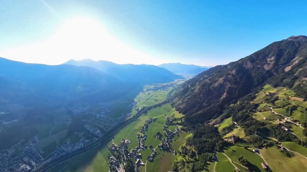
The return journey was by narrow-gauge railway in the Zillertal, with a landing beer in Jenbach in between, then onwards by regional train to Kufstein and by Bavarian regional train to Munich. At 22:15 I was at Munich Ostbahnhof. Tired, but my grin couldn’t have been wider.
Looking back, I am surprised that the glacier triangle can be done well with a B glider. However, unlike with competition gliders, the weather conditions, the pilot’s form on the day and the length of the day have to be right – there’s not much time for mistakes and tinkering on the route. With the sad melting of the glaciers, special glacier equipment is no longer necessary at this time of year. And yes – I was honestly surprised at how well you can keep up with the high performers with a B glider in good conditions. In the end, the performance group also ended up in the Zillertal – just with a few more kilometres on the vario. But with the same experiences and the same shining eyes. That’s exactly what we fly for.
The text was partly formulated with the support of ChatGPT.
Pilot & co-author:
Ralf Eichelsdörfer has been harmonising family, career and the most beautiful hobby in the world since 2010 and has always remained true to the B-Class.